

Application of three-tired structure technology in WebGIS
Article Text (Baidu Translation)
-
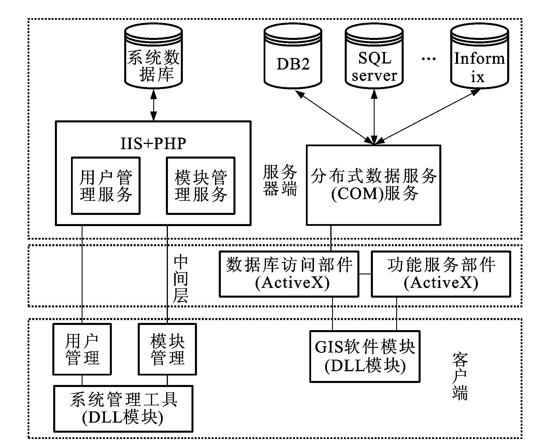
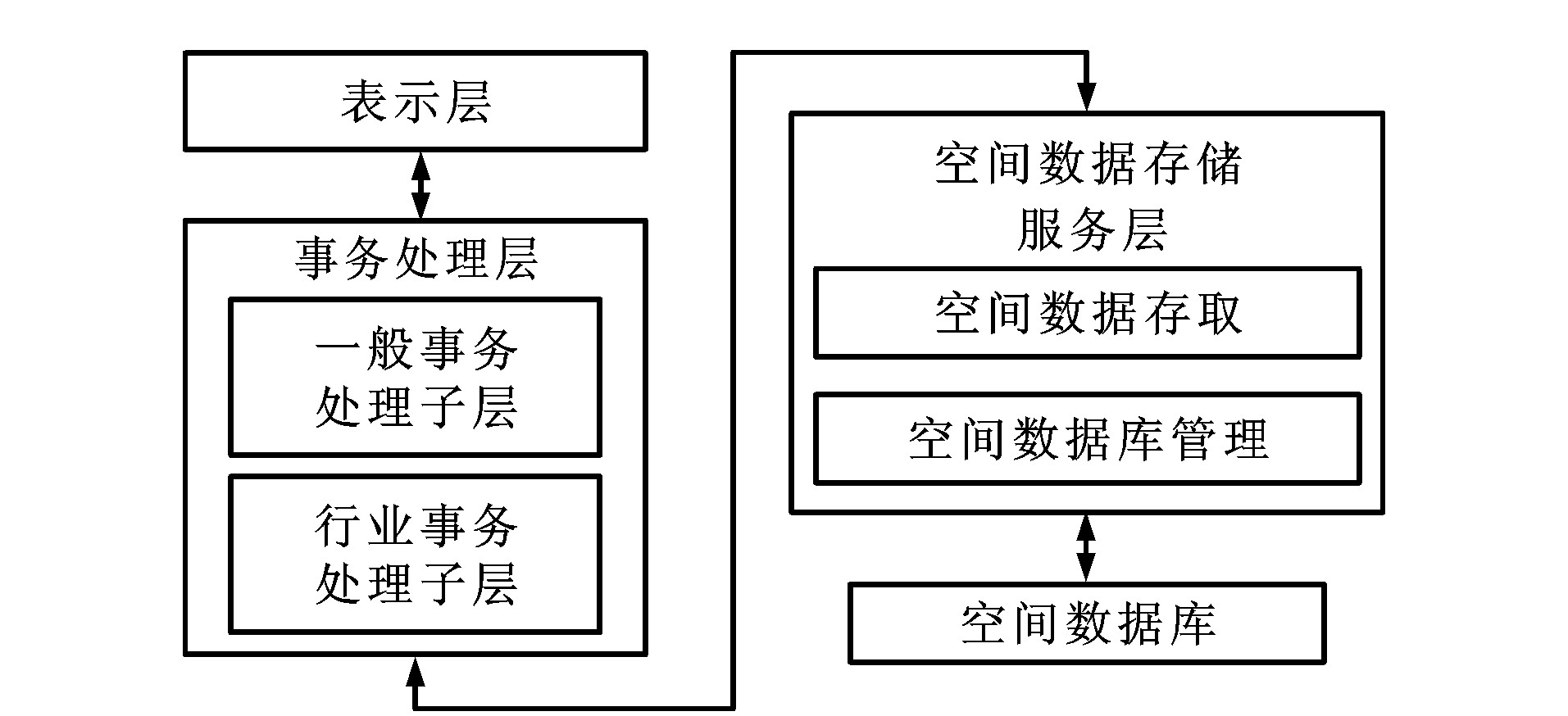
摘要: 为了寻找一种适合民航运输行业特点的GIS建设方案, 在比较了几种GIS设计方案, 分析了Web GIS的特点, 对目前三种主要的Web GIS实现方法进行了研究, 最终选择了三层结构的客户机/服务器模型作为实现民航运输地理信息系统的基本框架; 从逻辑结构和功能结构两方面, 对三层结构模型进行了详细介绍, 并简要介绍了三层结构模型在民航运输地理信息系统中的具体实现。通过实践, 尽管还存在一些缺点有待克服, 但三层结构客户机/服务器模式的Web GIS所具有的维护少, 操作简便, 客户端要求低, 可以较好平衡负载等特点, 使它成为一种理想的、适合民航运输业用户分散、数量众多、数据量大等特点的地理信息系统建设方案。Abstract: In order to find a plan to build the GIS that is suitable for civil aviation transportation, several current building plans for GIS and the characteristics of WebGIS were introduced and compared with each other. Three main methods for WebGIS building were analyzed. It is decided to take the three tired structure client/server model as the fundamental frame of the civil aviation transportation geographic information system (CATGIS). The three tired structure model was described. This model is realized in CATGIS. Through the practice, though the system has some disadvantages, but its advantages, such as less maintenance, simpler operation, lower requirement for users and easier allocation of loads, make it be an ideal scheme for building CATGIS, which meets the needs of civil aviation transportation.
-
Key words:
- civil aviation /
- WebGIS /
- three tired structure /
- GIS
-
[1] LIN Lian-sheng. Development and forward problems of geographic information system[J]. Jiangxi Hydraulic Science and Technology, 2000, 26(3): 137-143. [2] ZHUO Yong. Analysis of WebGIS technology[J]. PC World China, 1998, 49(1): 54-55. [3] XUE Xiao-feng, WANG Xiao-cheng. The research on the processing models of WebGIS[J]. Microcomputer Applications, 2000, 16(1): 26-27. [4] PENG Ming-jun. The research on the implementation and development of WebGIS[J]. Wtusm Bullerin of Science and Technology, 2000, 25(1): 41-44. [5] CHENG Chang-xiu, YAO Yan-min. The research of WebGIS based on the N-layer model[J]. Remote Sensing Information, 2000, 15(3): 5-8. -

 下载:
下载:
图(3)
计量
- 文章访问数: 480
- HTML全文浏览量: 190
- PDF下载量: 594
- 被引次数: 0
